CSMC
CSMCCentre for the Study of Manuscript Cultures
Photo: UHH/Denstorf
28 January 2022
Most people regard maps as an aid to help them get from one place to another. Diana Lange’s goal is simply to understand them rather than go anywhere. As her research on Tibetan cartography shows, maps can be a great deal more than just charts of an area, if they are read properly.
Lesen Sie hier die deutsche Version dieses Artikels
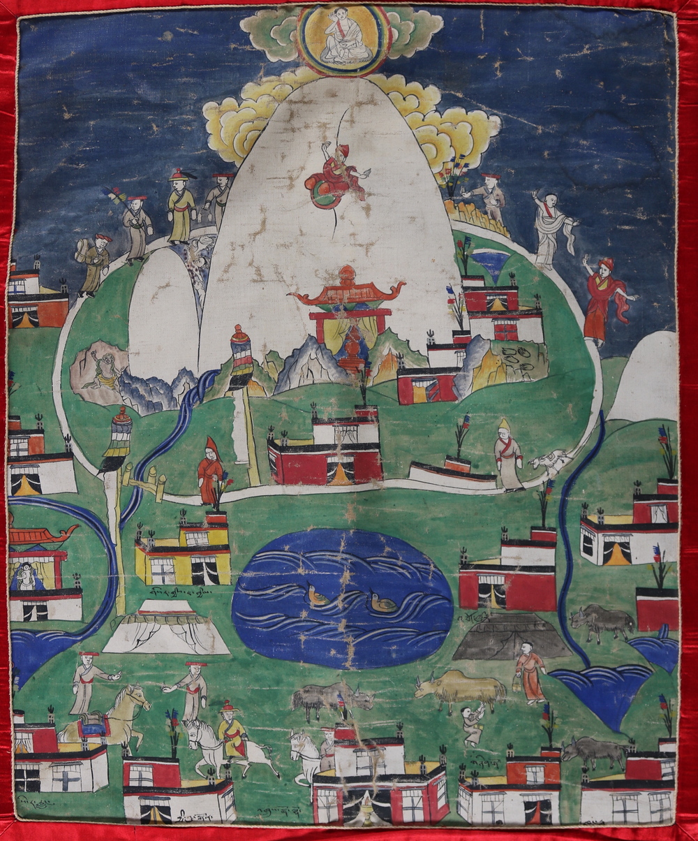
Is that supposed to be a map? Looking at the picture Diana Lange has chosen to illustrate her new research project, ‘Maps as Knowledge Resources and Mapmaking as a Process: The Case of the Mapping of Tibet’, you could be forgiven for having your doubts. It shows a saint hovering in the clouds above a white mountain surrounded by monks and pilgrims. Cattle are grazing at the foot of it and a nomad is milking a yak nearby. Tents have been put up next to monasteries on which Tibetan writing can be seen. Streams, rivers, and lakes form a colourful contrast to the luscious green countryside. This is a wonderful picture without a doubt, but is it really a map?
The confusion created in the viewer’s mind is intentional. The nineteenth-century 'Map of Mount Kailash and Surroundings' hardly meets any of the expectations that observers from the West tend to have about maps: it is not drawn to scale, for one thing, and the abstraction necessary to create an overview is absent. But whoever said maps can’t serve any other purpose than to help people get their bearings? Indeed, whoever said what a map is or isn’t?
Conceptual issues like these play a key role in Lange’s research. In her opinion, a map is essentially nothing more than ‘a spatial representation of a geographical region’. In this general sense, the term denotes far more than what can be found in a European school atlas. In fact, maps can impart all kinds of information, depending on who produced them, when, why, and for whom. Anyone unfamiliar with the area is bound to get lost if they try and use the 'Map of Mount Kailash' to get their bearings, but if they look more closely at what seem to be playful details, they will gradually realise that a considerable amount of information about the holy mountain in Western Tibet is actually shown in the picture. We Europeans are hardly able to grasp the meaning of maps of this type by thinking in terms of the usual categories we are familiar with. The long-term goals Lange is pursuing in her work are to make more headway here, use terminology more precisely, and broaden the narrow concept of maps that Europeans have.
The need to distinguish between ‘picture’ and ‘map’ is a reflection of a certain cultural background.
Walking into her office, one’s gaze automatically falls on a collection of large colour copies covering much of the wall. They show part of the Wise Collection of Tibetan picture-maps and drawings of Tibet and the Western Himalayas, which is kept at the British Library in London. Commissioned by a British Assistant Commissioner in the late 1850s, a Tibetan lama consequently drew up a series of maps that jointly form a fifteen-metre-long panorama of the region, which was practically inaccessible to Europeans at the time. These depictions of the country are a prime example of how Tibetan and European expectations diverged when it comes to maps. On what is probably the first of the charts he produced, the lama drew it from the perspective of traditional Tibetan cartography, in which the travellers' view is depicted as they walk along a river bank; the elements included in the map, such as mountains and buildings, are on either side or ahead of them. So if you happen to be walking along this route, the map lets you look in various directions. Half of the objects shown look upside down to an outside observer, though. The lama’s British client was presumably just as confused by this as Western viewers are today when they look at the 'Map of Mount Kailash', and he seems to have told him to adapt it, as a Western perspective was used consistently in all the other maps in the series. Lange has outlined the multi-faceted history of the Wise Collection in her book An Atlas of the Himalayas by a 19th Century Tibetan Lama: A Journey of Discovery (see Matthew Edney’s review of it for more background information).

Photo: The British Library Board
Map of Mount Kailash and surroundings in Western Tibet, from the Wise Collection. © The British Library Board, Add.Or.3015 f4.

Photo: The British Library Board
Map of the Kyichu Valley east of Lhasa, from the Wise Collection. © The British Library Board, Add.Or.3017 f1.

Photo: The British Library Board
Map of the Zangskar Valley in the Western Himalayas, from the Wise Collection. © The British Library Board, Add.Or.3018 f3.
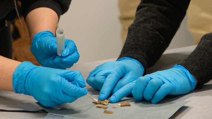
She returns to the theme of Tibet again in her new project, having spent the three previous years working in a different project called ‘Coloured Maps’, in which she examined maps that originated in East Asia. Collaboration between specialists in the natural sciences and material science was of key importance in researching the coloration of such charts: ‘Our work together was the first time I realised just how beneficial cross-disciplinary research can be and how much the natural sciences and humanities can complement each other when it comes to understanding maps, their history, and materiality,’ says Lange. The aim of the new project is to combine these two areas – the thematic focus on Tibet and the methodological focus on materiality and cartography. Rather than restricting the study to a particular group of maps like those in the Wise Collection, Lange now aims to get a view of Tibetan cartography in its entirety.
But why Tibet of all places? By taking a look at this region, it becomes particularly clear how much mapping processes can vary from culture to culture and just how different mapmakers’ interests can be. Depictions of Tibet vary, depending on what perspective was employed. The contrast between indigenous, Chinese and European points of view is striking here. From a Chinese viewpoint, what was particularly important in documenting Tibet cartographically from the end of the eighteenth century onwards was mapping the region and its southern borders with China’s own defence policy in mind. Europeans, in contrast, were more interested in documenting one of the last blank areas still on their maps. Whoever intends to control a geographical region or make it capable of being controlled would want to document it as fully and accurately as possible – a mission pursued more ruthlessly in nineteenth-century Europe than anywhere else in the world. The fact that other aspects such as spirituality are more important to Tibetans possibly explains why their maps differ so fundamentally from Western ones – indeed, so much so that Westerners do not see them as maps at all, but as pictures. The need to distinguish things this way is a reflection of their cultural background, however. The Chinese have a different concept in this case: ‘These two terms are represented by the same character in Chinese. That’s why nobody ever thought of drawing such a strict dividing line,’ Lange explains. The various cultural and cartographic inventions developed by the Europeans, Chinese and Tibetans mean that they produced maps that are very different in terms of their content and appearance.
Over the next three years, Lange hopes to be able to read old maps of Tibet in a new way, compare them, and subsequently shed more light on the historical and social background of how and why they were made thanks to material science. The astonishing thing here is that, by carefully examining maps that seem totally unconventional, we can actually chart unknown territory.