CSMC
CSMCCentre for the Study of Manuscript Cultures
Photo: UHH/Denstorf
27 May 2024
In this new post, Assyriologist Cécile Michel talks about the large-scale plans and maps made by the ancient Mesopotamians, including the oldest known map of the world, drawn in clay.
In this new post, Assyriologist Cécile Michel talks about the large-scale plans and maps made by the ancient Mesopotamians, including the oldest known map of the world, drawn in clay.
The ancient Mesopotamians drew up plans of fields and buildings on clay, and their mathematical tablets were sometimes illustrated with diagrams showing the steps involved in solving problems. Large-scale plans or maps of towns or regions, which are rare, occasionally provide numerous pictorial details accompanied by legends. The oldest known map of the world was also drawn in clay.
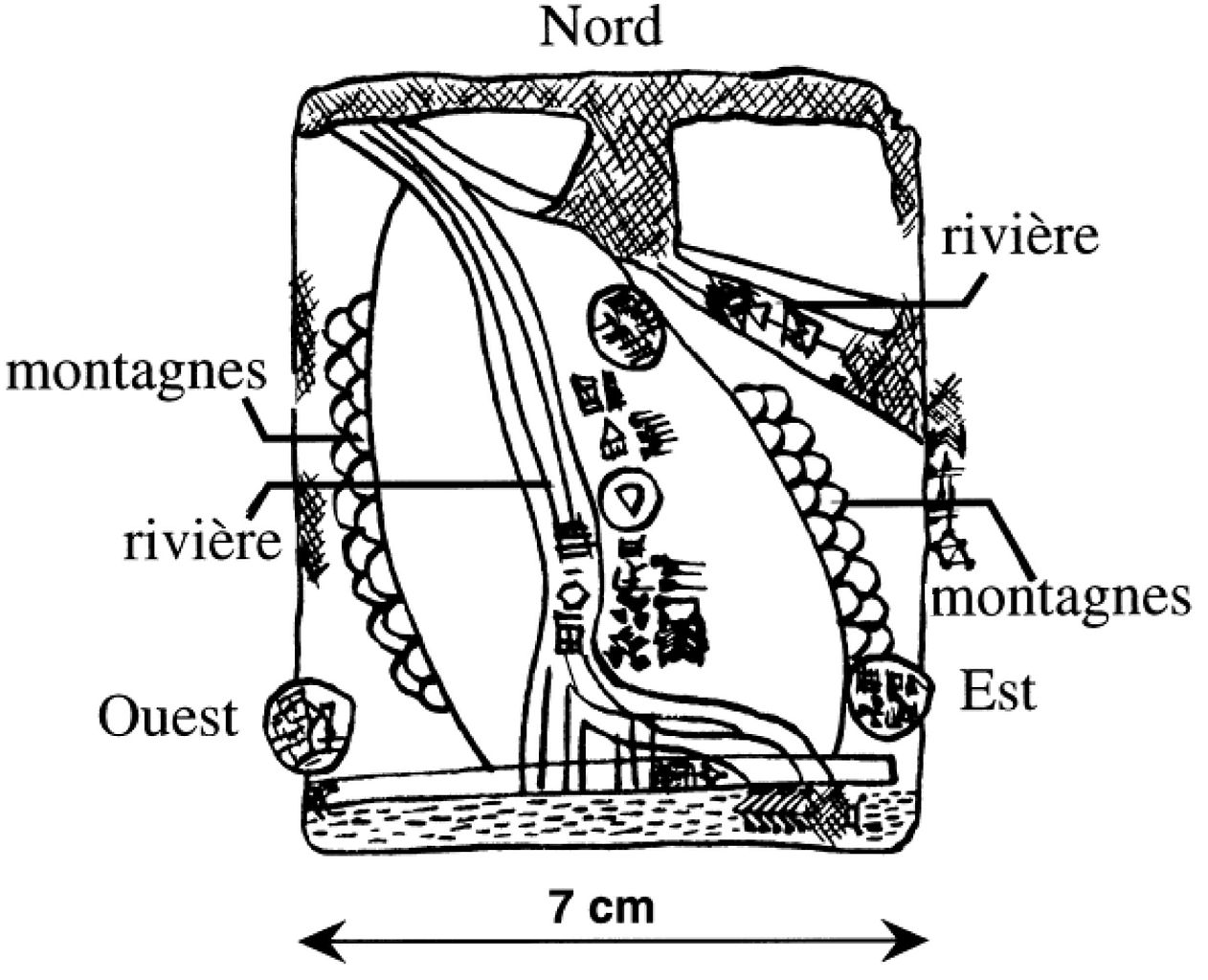
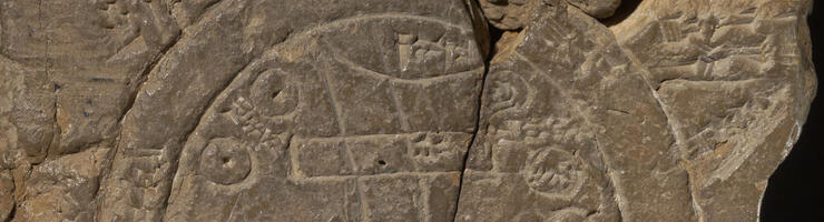
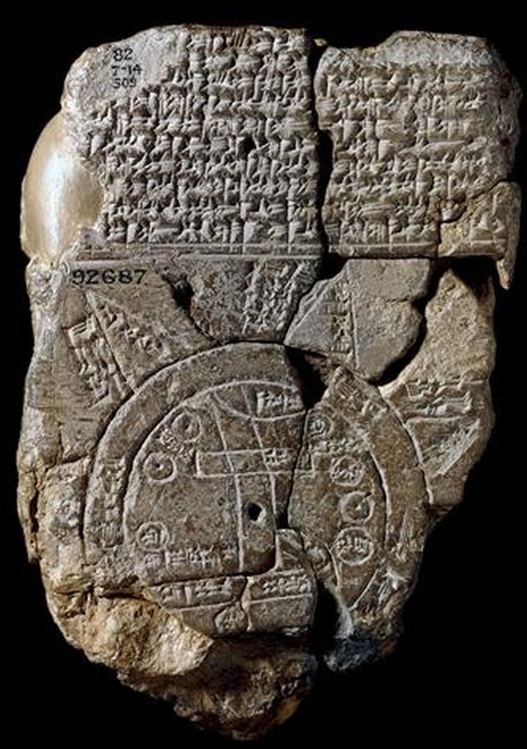
Among the hundreds of thousands of cuneiform tablets discovered at sites in the Near and Middle East, the oldest map probably depicts the region of Gasur (later known as Nuzi) and dates from the 24th century BCE. This map includes the region between the Zagros mountains and the outskirts of Kirkuk, which is framed by mountains to the east and west. The two rivers are the Tigris and its tributary the Lower Zab, and the towns are shown as circles.
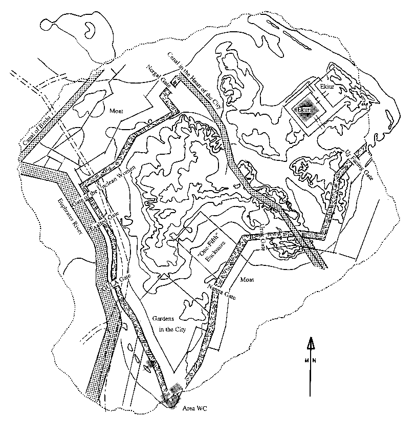
The map discovered at Nippur, dated to the Medio-Babylonian period (middle of the 2nd millennium BCE), shows the religious and cultural city fairly accurately and faithfully. It is surrounded by ramparts pierced by seven gates, with the Euphrates flowing to the left. Several canals border and cross the city. This map can be put into perspective with the plans drawn up by the American archaeologists who excavated the city.


Another map from the same period shows farmland around Nippur. It shows a winding canal from which irrigation channels of various sizes branch off to supply water to the fields. The circles represent hamlets. The field in the centre of the map belongs to the palace, and the one just above it to the god Marduk, the main god of Babylonia.
On another scale, the Babylonian Map of the World represents the surface of the earth as it was imagined at the very beginning of the first millennium BCE. The copy in our possession, now in the British Museum, dates from the seventh century BCE. It was unearthed in the city of Sippar. This map does not respect the distances or relative locations of the geographical features represented.
On the face of the tablet, the earth appears in the form of a disc surrounded by a circle of a certain thickness from which triangles radiate. The central disc corresponds to the continent: from the Taurus mountains at the top flows the Euphrates, which makes a bend as it flows through Babylon, shown as a rectangle. The river disappears into the marshes after feeding the Shatt al-Arab, a sort of side canal. On the right of Babylon, from top to bottom, are circles representing Urartu (Armenia), Assyria and Dêr, and on the left, Habban and the Bît Yakîn. The city of Susa lies to the south of the marshes. The land is surrounded by the ocean, beyond which are triangles representing distant lands and imaginary islands, one of which bears the following legend: "place where the sun is not visible" (north).
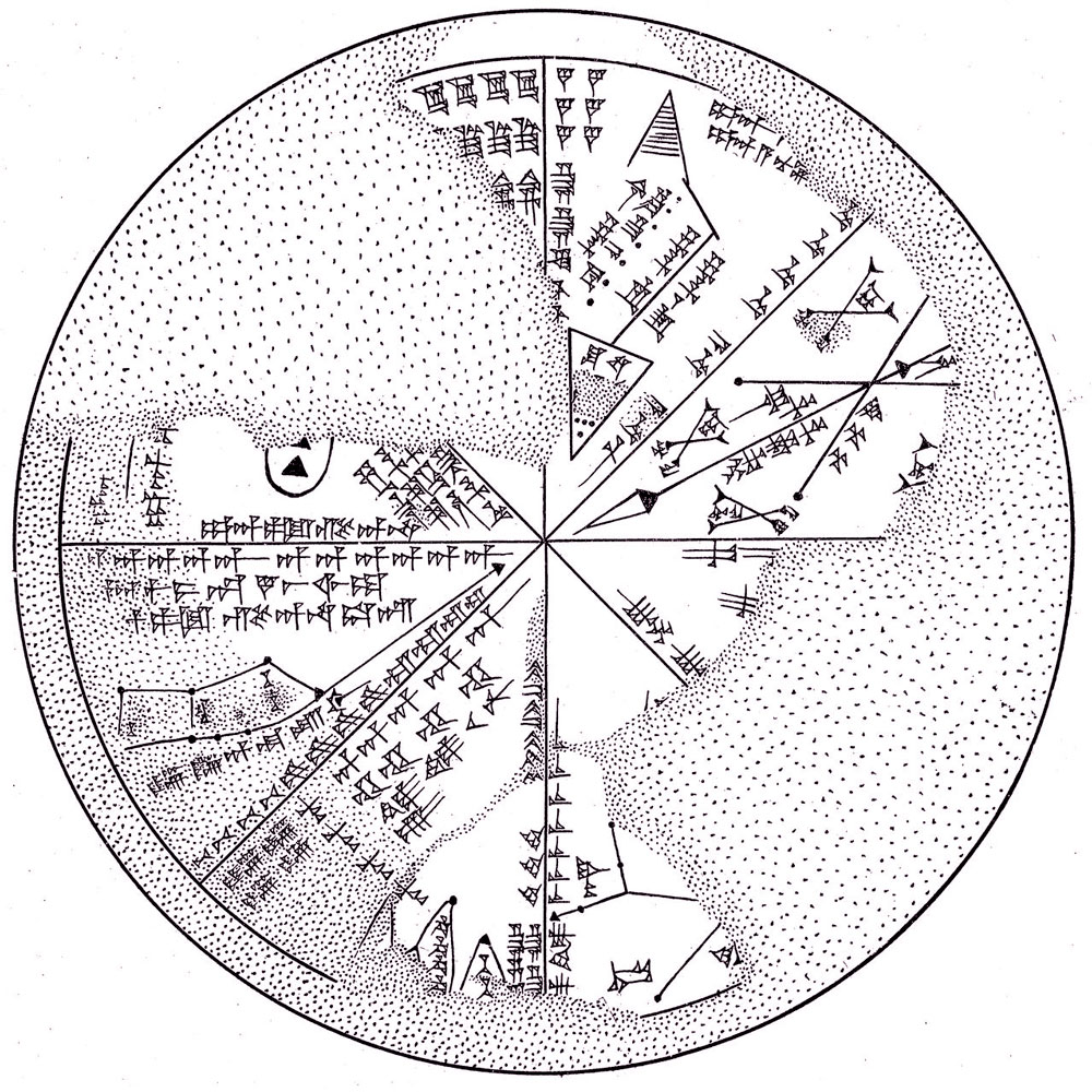
The short mythological text on the side accompanying this map mentions the distant places where legendary heroes ventured: Utanapištim, the immortal Babylonian Noah who lived on an island; King Sargon of Akkad, who crossed the limits of the real world during his military campaigns; and his adversary, Nûr-Dagan, king of Burušhanda in Anatolia.
The text on the reverse, no doubt added by the copyist, describe the regions beyond the ocean consist as places with a special climate, exuberant flora and marvellous fauna.
As well as practising cartography at different scales, the inhabitants of Mesopotamia also tried their hand at drawing constellations in the sky. A clay disc discovered in Nineveh and dating from the 7th century BCE is divided into eight parts, each containing a drawing of one or two constellations, along with a magical text.
All these maps suggest that the inhabitants of the Ancient Near East excelled at observing their environment and their planet.


.jpg)